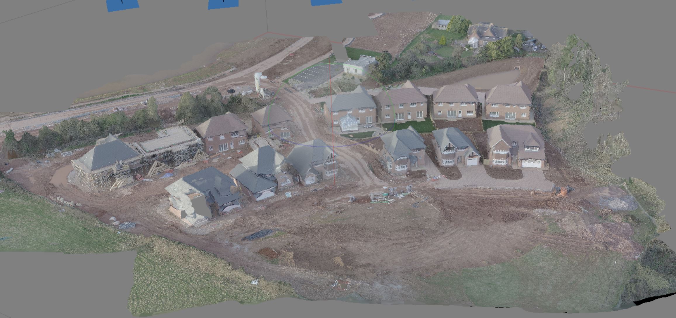
Construction sites commonly use 3D models to evaluate the topography of a site, identify earthmoving needs, and to monitor progress of projects against project schedules. Other industries using drone-based 3D modeling include mining and inspection
Construction sites commonly use 3D models to evaluate the topography of a site, identify earthmoving needs, and to monitor progress of projects against project schedules. Other industries using drone-based 3D modeling include mining and inspection