


Pre Programmed Flight Paths
Preprogramed GPS points uploaded to the UAV this allows for precise flight positioning, high mobility, repeat ability and ease of use. Live video feed from the camera the client is able to see the images as the project takes place on the ground. 3D models created using our UAV
Aplications
We can cover aerial and ground based video and photography. From inspection to television let us help you
Total Coverage
We also cover ground based photography and video as well as a dedicated imaging suite. SLR cameras, lighting, video and steady cams. Making us a one stop solution.
We can cover aerial and ground based photography and video
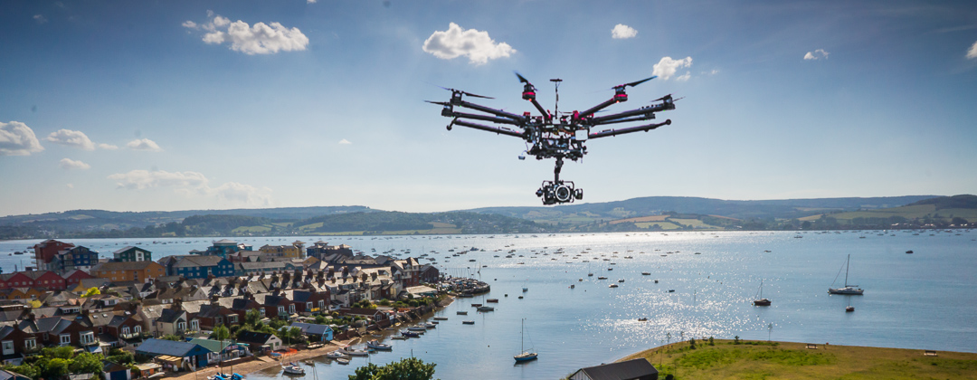
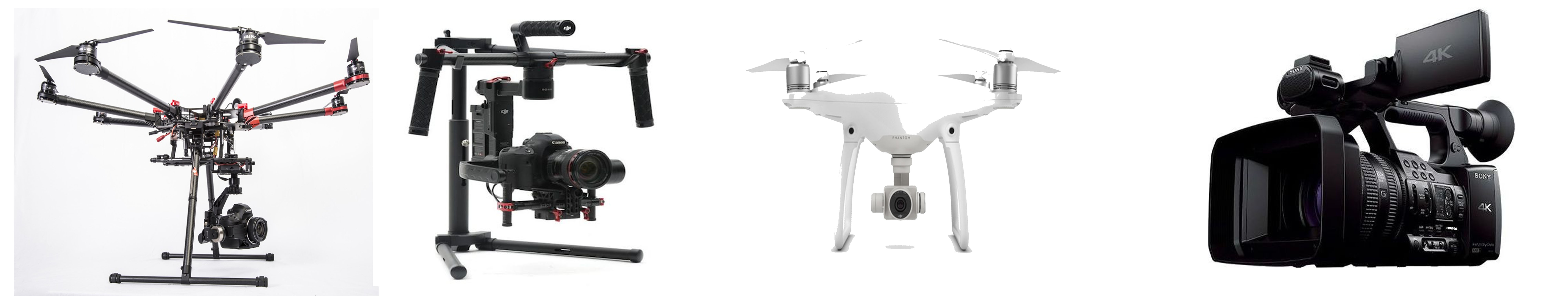
DJI S1000 Octocopter
This Octocopter caries a Lumix GH4 Camera. It can be operated by two people, one to fly the Octocopter and the second has total independent control of the camera. This enables smooth panning shoots broadcast quality 4k video at 200Mbs.
DJI Ronin steady cam
This complements the Octocopter by transferring the camera to the Ronin the same steady shots can be achieved on the ground. This can be one or two person operated for total smooth video work while running or driving.
DJI Phantom 4 Pro
This Quad copter is very advanced small and light. It is possible to upload pre planned flight planed for autonomous flight. Independent gimbal for stabilized images and upto 4k video. Great for inspection work and property photography.
Panasonic Professional Video Camera
This camera is mounted on a fluid head tripod for smooth video. This complements our equipment to be able to give full video coverage what ever the need. We have a full editing suite to be able to put all of the different footage into one seamless video including the titles and sound. Shooting 4k broadcast quality video.
Advanced Waypoint GPS Navigation Technology
Pre Loaded Waypoint maps With Ground Tracking Capability
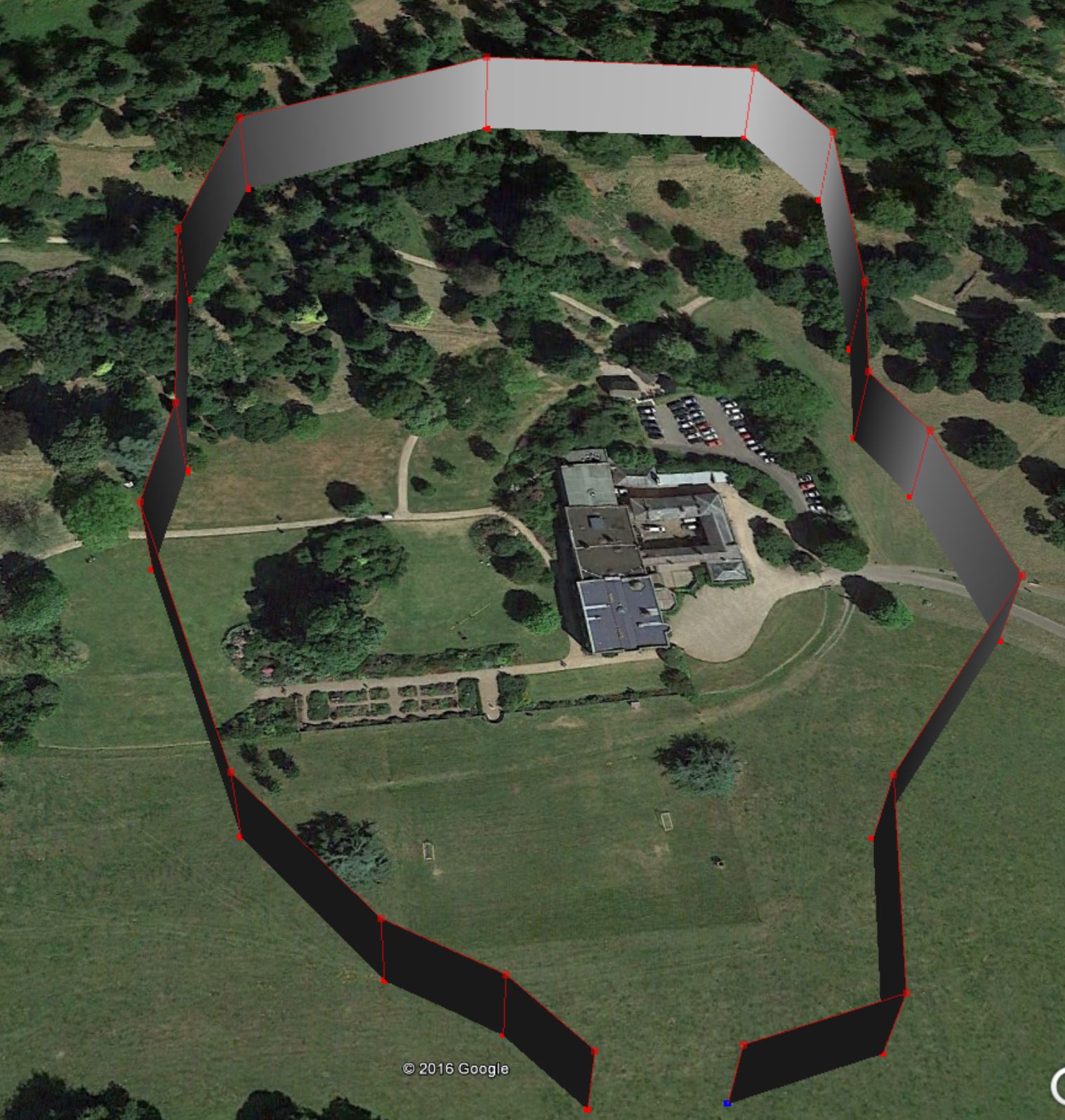
We can upload a predetermined set of waypoints to enure repeatability and acuracy
Cost effective solutions to get the aerial images that you need to stand out from the crowd.
We can provide an easy and cost effective solution to get the aerial shots that are now possible using the latest Unmanned Aerial Vehicles (UAV). Not only do we have the latest aerial equipment but we are established commercial photographers and have a full range of digital SLR cameras and studio lighting to cover more traditional photography. We also have a dedicated editing suite on site make us a one stop solution.
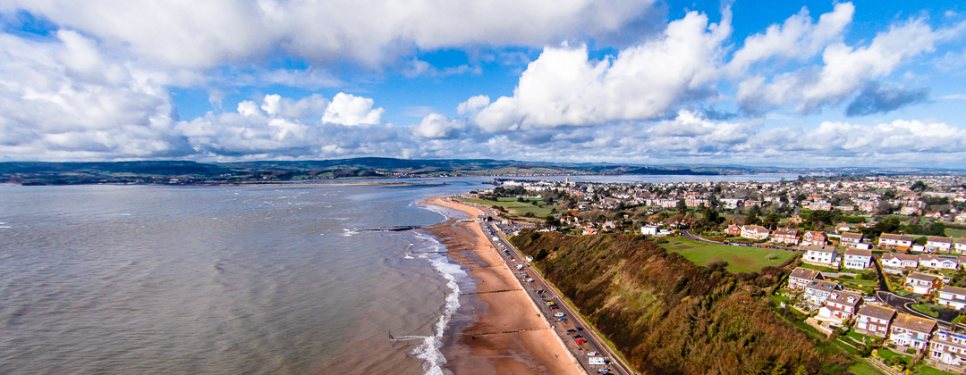
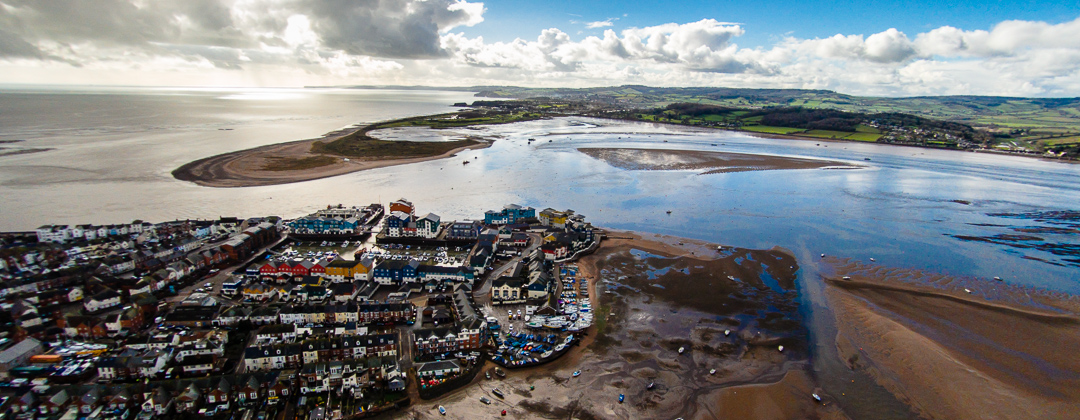
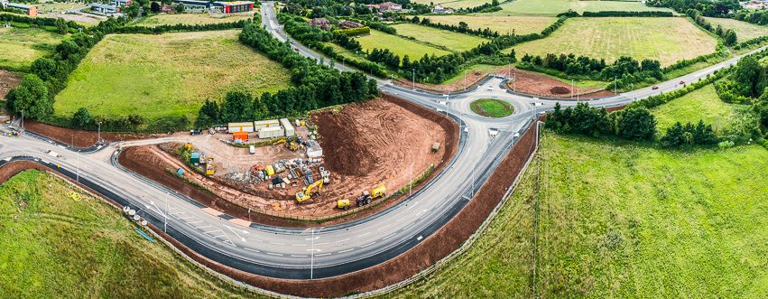
Our aerial photography produces amazing quality HD video suitable for both film and TV. We can also cover sectors including surveying, promotional, inspection and events. We use fully licensed pilots who have successfully undertaken the EuroUSC Light scheme to obtain accreditation. The very latest Hexacopters are built in house to the highest standard by the pilots who fly them. Each one individually calibrated and approved for flight by EuroUSC.
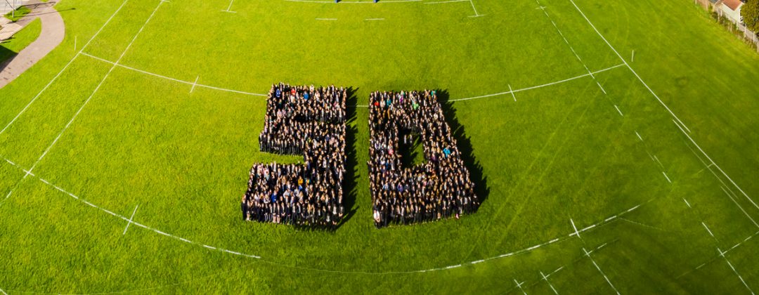
High definition aerial footage is now available to everyone.
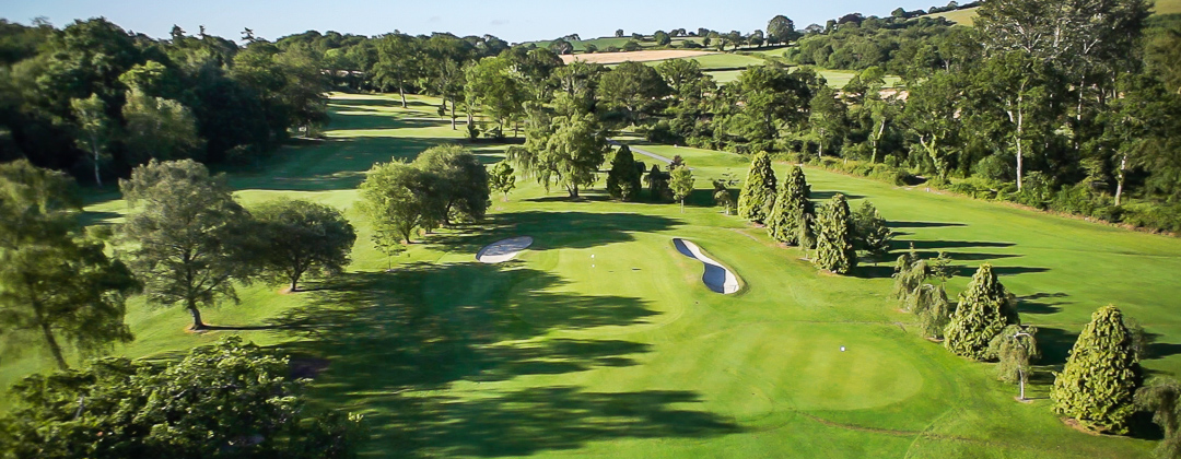
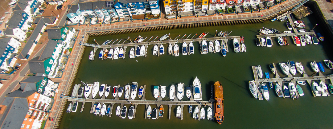
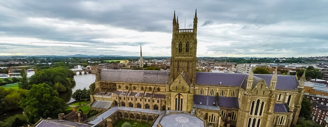
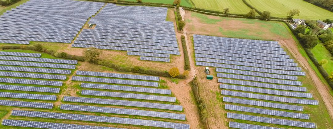
Aerial Imaging Applications.
• Power Line Inspections
• Cliff stability Inspections
• Bridge Inspections
• Roofing Inspections
• Wind Turbine Inspections
• Construction
• Maintenance planning
• Archaeological Surveying
Benefits of UAV Filming
• Fast Deployment
• Instant Live video feed to ground
• Video and Photography
• Cost Effective compared to rigging, cherry picker and helicopter hire.
• Imaging immediately available for inspection
• Filming over water & place a helicopter can not operate
• Ground level to 400 ft.
Specifications of our UAV
• Fully stabilised gyro mounted camera filming at 4k @24fps. UHD @ 30fps. 1080p up to 96fps.
• Ability to shoot in V-log for higher Dynamic Range
• Independant control for the camera man allowing for greater camera control with two man operation.
• Fail safe return to home and land in the event of signal loss
• Eight brushless motors allow for safe flying in the event of an engine failure
• Full live video feed to the ground from both cameras.
• Camera system allows for full 360 degree pan and tilt operation from the ground
How your project is planned and how we work onsite.
What is included in the service we provide
• Pre-flight survey and planning
• Civil Aviation permissions where needed
• Full third part liability
• Full risk assessment
• Full equipment to include gyro stabilised gimbal, camera
• All necessary equipment to undertake the task
We can also offer video editing and photograph retouching to your specification.
Contact us NOW for an informal chat about your Requirements.
3D rendered images from photographs

3D cloud point images from a UAV